1/16


विवरणरिव्यूसंस्करणजानकारी
1/16
का विवरण ArcGIS Earth
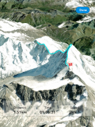
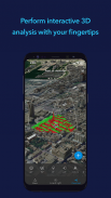
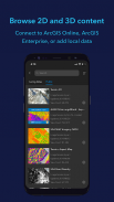
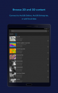
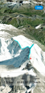
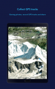
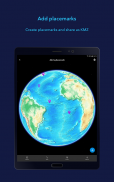
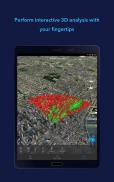
ArcGIS Earth is an experience designed specifically for knowledge workers who need to rapidly display data on the globe, understand shared information in the context of location, and aggregate and create data with links and images to communicate critical information about events, plans, and operations in the world.
ArcGIS Earth - Version 2.0.0
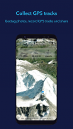
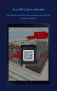
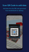
(23-12-2023)What's new- Support KML and KMZ. - Tap on the globe to identify feature.- Tour feature allows user to take pictures and then plot on the globe.- User can input portal URL and access secured contents.- Remember last state. - 1st angled camera view removed
अच्छी एप्प की गारंटीइस एप्प ने वायरस, मैलवेयर व अन्य दुर्भावनापूर्ण हमलों के लिए सुरक्षा परीक्षण पास किया और इसमें कोई जोखिम नहीं है।
ArcGIS Earth - एपीके जानकारी
एपीके संस्करण: 2.0.0पैकेज: com.esri.earth.phoneनाम: ArcGIS Earthआकार: 170 MBडाउनलोड: 445संस्करण : 2.0.0जारी करने की तिथि: 2023-12-23 02:58:19न्यूनतम स्क्रीन: SMALLसमर्थित सीपीयू: armeabi-v7a, arm64-v8a
पैकेज आईडी: com.esri.earth.phoneएसएचए1 हस्ताक्षर: DB:44:CB:80:C0:A8:0F:69:42:D0:86:54:DD:AE:7E:BE:90:01:56:E0डेवलपर (CN): David Cardellaसंस्था (O): Esriस्थानीय (L): Redlandsदेश (C): USराज्य/शहर (ST): California
Apps in the same category
You may also like...

English


